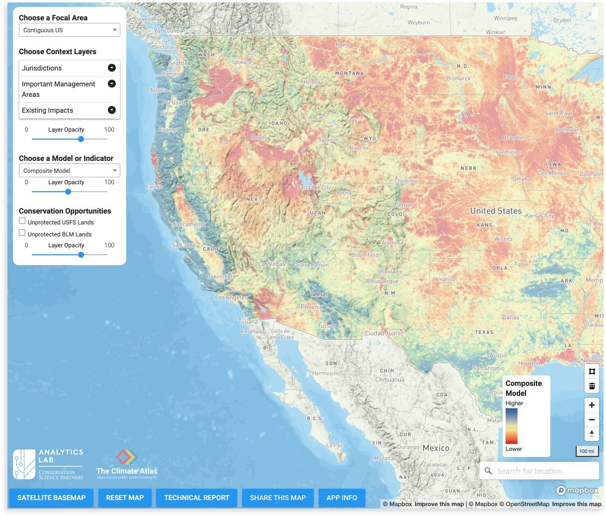
The Climate Atlasoffers one of the clearest assessments available of the climate and biodiversity benefits that a given landscape in the U.S. provides.
Use The Climate Atlas to:
View baseline data on the health and status of a landscape, and what the government is currently doing (or not doing) to protect it.
Identify which public lands offer the best opportunities for storing carbon, supporting wildlife and species richness, and protecting biodiversity.
Help inform and prioritize which public lands to protect based on the values you select.
Other public lands benefits and cultural values, including Indigenous connections and recreation economies, are not yet included in the tool.
Using The Climate Atlas’ innovative approach, you can:
Search by Location
Search for a location coast-to-coast (plus Alaska!), or click on a pre-defined region.
Add Context Layers
See whether the landscape is currently protected and federally managed, or impacted by oil and gas development.
View Climate Indicators
Explore how public lands mitigate climate change through carbon storage and contribute to overall climate resilience.
View Biodiversity Indicators
Explore the value of public lands in protecting biodiversity, including their ability to support species’ richness and movement.
View Aggregate Models
Get a scientific snapshot of which lands have the highest conservation value based on climate and biodiversity factors.
Identify Conservation Opportunities
Discover the conservation opportunities that lie in currently unprotected public lands.
Case Studies
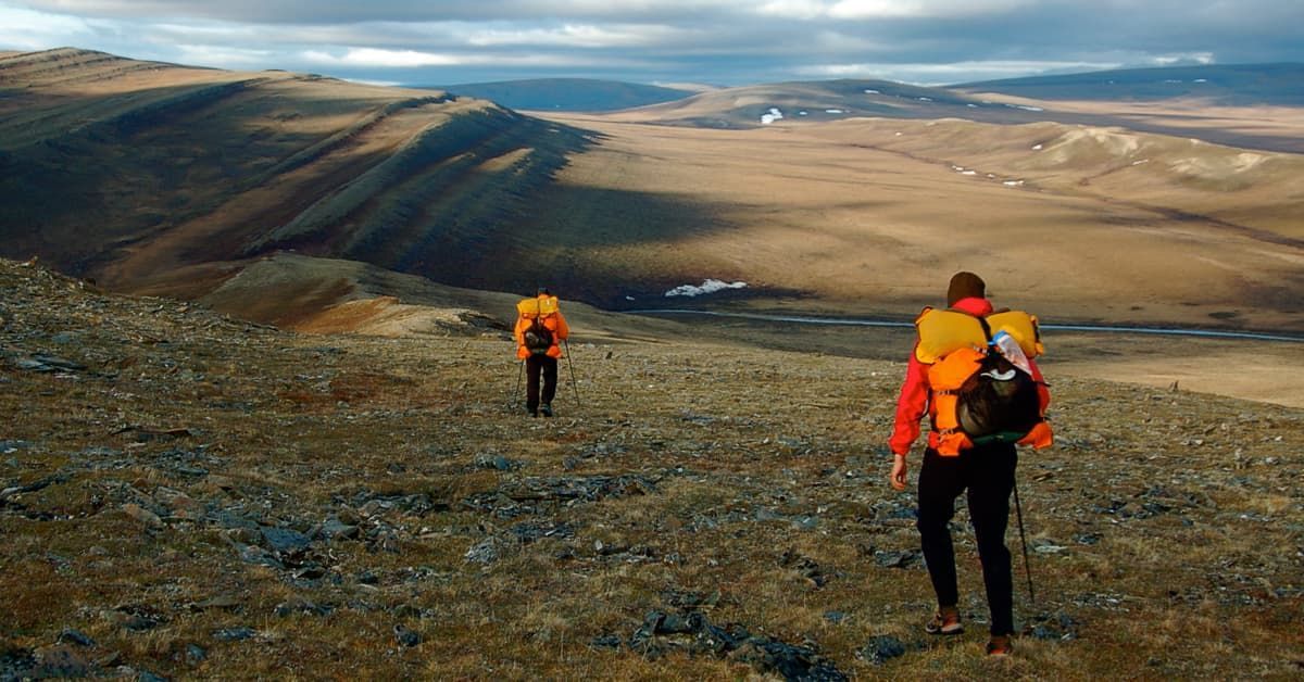
Western Arctic Reserve, Alaska
This 21 million acres of unprotected arctic terrain has low climate stability, with the future climate expected to be very different from today’s. The area has lands that rank in the top percentages for carbon storage, ecological intactness, and other biodiversity values.
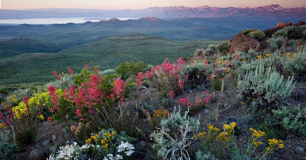
This roughly 123,000 acres of unprotected alpine terrain has high ecological intactness and species richness – from sage grouse to Sierra juniper. Due to its strong biodiversity values, parts of the Bodie Hills area are in the top 10% of all unprotected Bureau of Land Management lands in California based on biodiversity factors.
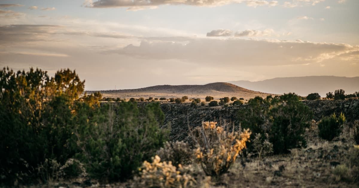
This vast acreage of unprotected volcanic plateau remains highly ecologically intact and plays a key role in helping species adapt to climate change. Due to its high ecological stability and climate resilience, parts of Caja del Rio are among the top 20% of unprotected BLM and Forest Service lands with the highest conservation value in the lower 48 U.S. states.
Thank you for contacting us. We will get back to you as soon as possible.
Oops, there was an error sending your message. Please try again later.
*By clicking "Sign up", you consent to receive periodic updates from Conservation Lands Foundation by email, text and/or phone. You can unsubscribe or text STOP at anytime. Message and data rates may apply. Read our privacy policy.